Tuesday, Nov. 23, 2010 • Panel discusses Eagle Lake water level
Publisher’s note: This story originally appeared in the Tuesday, Nov. 23, 2010 edition of the Lassen County Times.
The water level at Eagle Lake is as low as it’s ever been, and with the large number of contributing factors as to why it hasn’t risen have led to a lot of confusion.
That’s why a panel of experts, the Lassen County Board of Supervisors and a crowd of roughly 150 community members came together to gather information and discuss the lake water level at Jensen Hall at 1:30 p.m. on Tuesday, Nov. 9.
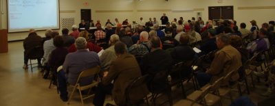 Roughly 150 people showed up on Tuesday, Nov. 9, in attendance to hear about what could be done with the Eagle Lake water level.
The panels included experts and representatives from the Quincy Library Group, the U.S. Forest Service, the Bureau of Land Management and a member from the U.C. Davis Cooperative Extension, who were on hand to present a multitude of information about the lake.
Topics included how the watershed surrounding the lake is supposed to gather water back into the lake, how volcanic rocks affect water flow because of the many fractures and joints it can contain, the various issues surrounding the Bly Tunnel’s effect on the lake, PG&E cloud seeding in the region and how a higher tree density can affect the yield from a watershed.
“Just to emphasize, it’s almost impossible to try and understand what’s going on in Eagle Lake if you don’t understand where the water is going,” said Shawn Wheelock, a hydrologist with the U.S. Forest Service’s Eagle Lake Ranger District.
After each panelist brought forth their figures and information, the audience was allowed to ask questions and get answers on more specific questions.
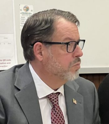 Maurice Anderson.
Department of Planning and Building Services Director Maurice Anderson gave an update on the lake level prior to the speakers, explaining the lake level was as low as it has ever been.
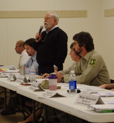 Water lawyer Michael Jackson was one of the first speakers at the study session, emphasizing everyone needed to work cooperatively to solve the lake’s problems.
Water lawyer for the Quincy Library Group Michael Jackson said there are several other lakes and bodies of water in Northeastern California that are dealing with similar depleting water levels.
“I’m not here to discuss whether or not this is a result of global warming,” Jackson said. “Because it doesn’t seem to matter what the cost of what’s happening is. It’s consistently happening throughout the west. I have my own beliefs, but what matters is how we adapt to the situation we’re now being confronted with.”
Jackson called for a plea to have people work together as much as possible. He said the lake’s current state wasn’t because of any one particular group or set of factors, but many. As a world-renowned location for fishing, Jackson said many of his clients had a major interest in the long-term stability of the lake, as well as the residents who called it home.
Jackson said according to the state of California, the state is currently in a 15-year oscillation period. Based upon when lake levels were much higher in 1999-2000, he said it could be possible to expect wetter weather in the next two to three years, possibly even this winter season.
The gathered panel of experts also discussed a number of other possible contributing factors to the lowered lake levels. Forest Hydrologist Sherry Mitchell-Bruker explained a little bit about how the Eagle Lake Watershed worked, how the land around Eagle Lake drained into it to feed it water. Mitchell-Bruker said the water in the lake is fed by both ground water and surface water.
Wheelock explained that water shed was compounded by the amount of volcanic rocks and basalt in the area, which can lose water through the various fractures and joints.
Wheelock also said Pine Creek was being watched very closely, because it was estimated that 70 to 75 percent of Eagle Lake’s surface water was generated from the creek. As far as results from the amount of ground water that made its way into the lake, Wheelock said the volcanic geology made groundwater flow difficult to quantify. He said the ultimate determining factor for the lake has been and always will be the weather.
BLM Forester Wade Salverson also explained there was a direct relationship between tree density and the yield of water from the watershed into the lake. Essentially, there are more trees per acre in the area than in previous years when the lake level was higher. Because the abundance of trees has been capturing much of the precipitation, he said programs for reducing the tree density could theoretically increase the yield of water into the lake.
Public comment
Once each of the experts spoke on their specific field and how it related to the lake, the floor was opened up for a period of questions and answers. The two topics that immediately came up from the audience were the possibility of cloud seeding from Pacific Gas and Electric and the adverse effects of the Bly Tunnel on the lake level. Arlen Higgins with the Desert Research Institute in Reno, who had worked with cloud seeding programs most of his career, said with the five seed-generators in the Lake Almanor Basin, the affect from the five to 10 percent increase on that lake had been minimal.
Eagle Lake resident Doc Bateson said he had read a study that had determined the effect was closer to a 55 percent precipitation increase.
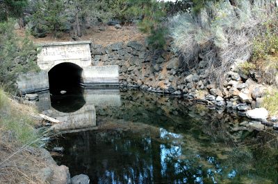 The Bly Tunnel was constructed in the 1920s to carry water from Eagle Lake to Willow Creek Valley. Ranchers quickly learned that the water from the lake was too alkaline to be used for irrigation, so the tunnel was plugged.
As for the Bly Tunnel, since many residents believed much of the water was still leaking through the tunnel, community member Don Armentrout proposed a monitoring plan be put in place to make sure people weren’t shutting the release valve in the tunnel on and off.
Integrated Water Resources Management Plan
As for ways that people can more actively participate in trying to help Eagle Lake, U.C. Davis Cooperative Extension Agent David Lile said the use of an integrated water resources management plan was a great first step.
According to Lile, in order for the involved parties to obtain state funding for watershed management and similar projects, areas are required to develop and adopt an IWRMP. It starts with the regional acceptance process, which the present state and federal agencies planned to have finished by the end of winter.
That consists of defining the geographic area, establishing the water management history and issues, defining the stakeholders, who has authority over the water and the processes attached to those groups.
The following step would be to obtain funding, which for this project would most likely come from the funding cycle in spring of 2011. The final step would be the actual planning process, which would take place in the summer/fall of 2011.
Lile said representatives from watersheds throughout the Northern California region would be needed for the process as well as to act as community liaisons. These representatives would also be needed to identify and formalize priority issues as they pertain to their respective watersheds as well as coming up with management actions.